France Historique et Politique à l’usage des Cours Secondaires par Melle Victorine Robert


FULLY ILLUSTRATED DESCRIPTION: France Historique Victorine Robert 1865
Robert, Victorine. France Historique et Politique à l’usage des Cours Secondaires par Melle Victorine Robert.
[France, c. 1860-65 {before 1901}]
(25.5 x 34.5 cm). Oblong folio. 38 leaves for France, maps and demographics; 25 leaves for “Contrées de l’Europe”. Contemporary cloth spine over thick card stock covered with patterned black paper, covers rubbed and edge worn, cloth at the head and tail loose and worn, sewing starting to loosen, but holding, some soft corners, but internally a clean and very well-preserved album.
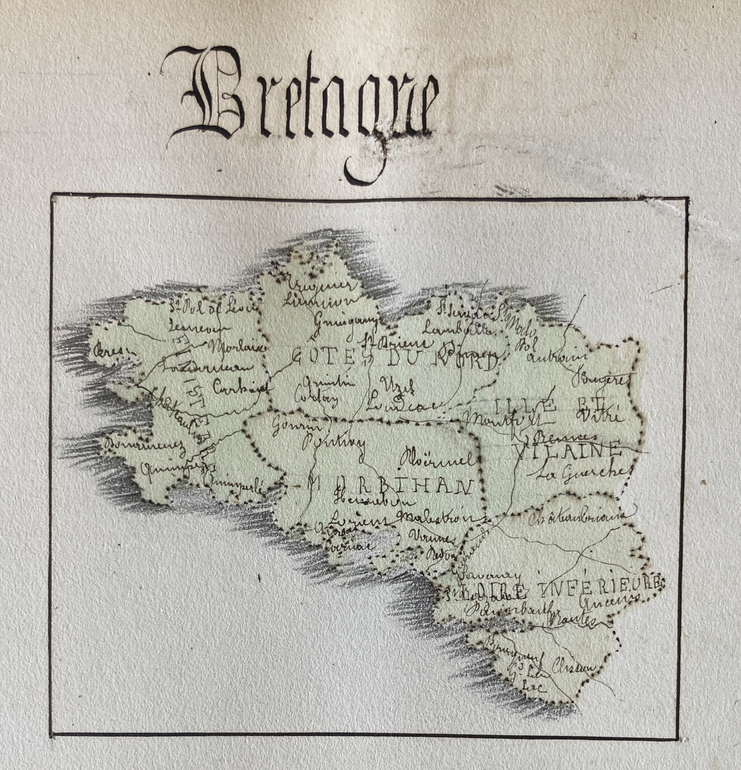
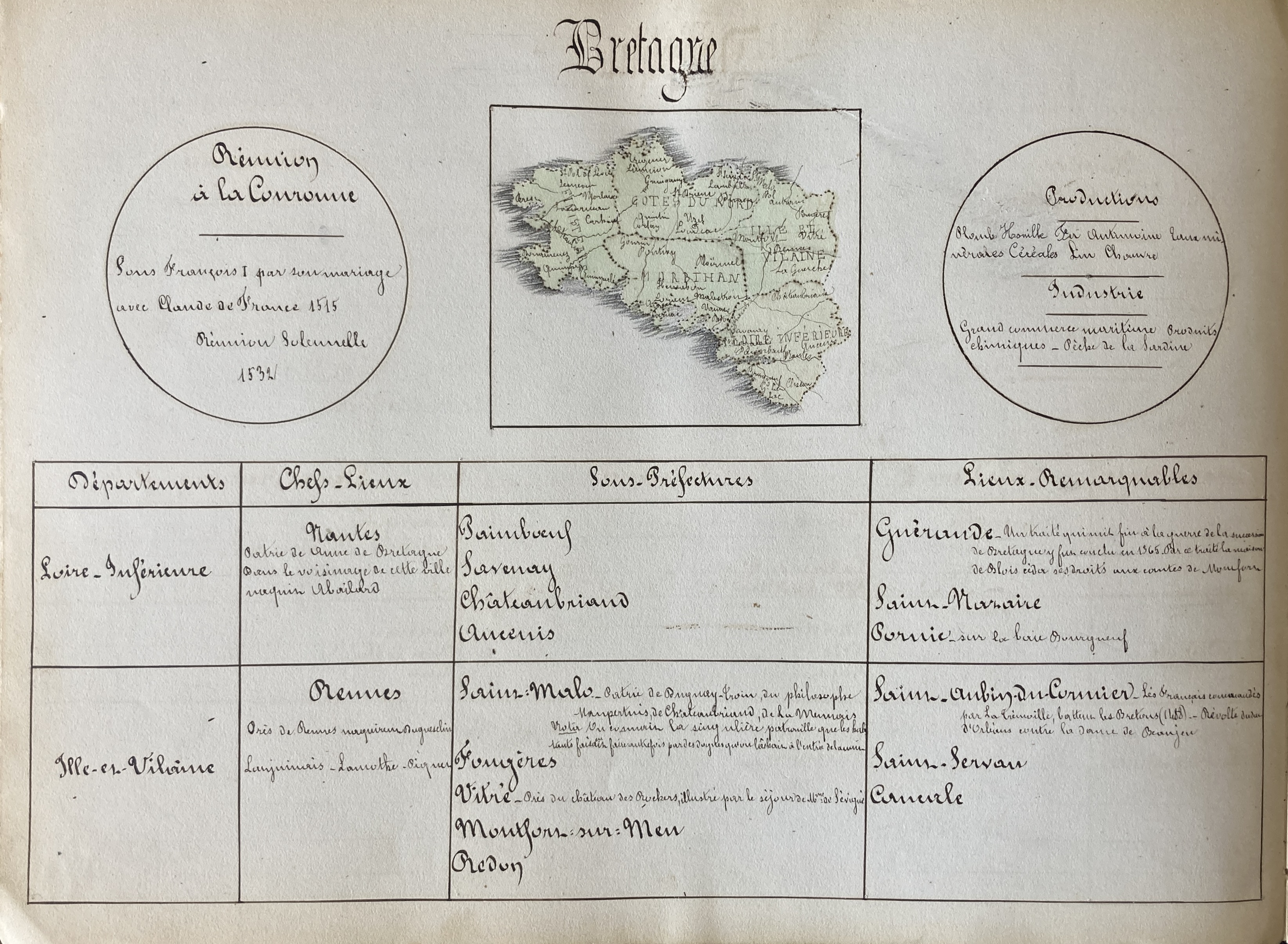
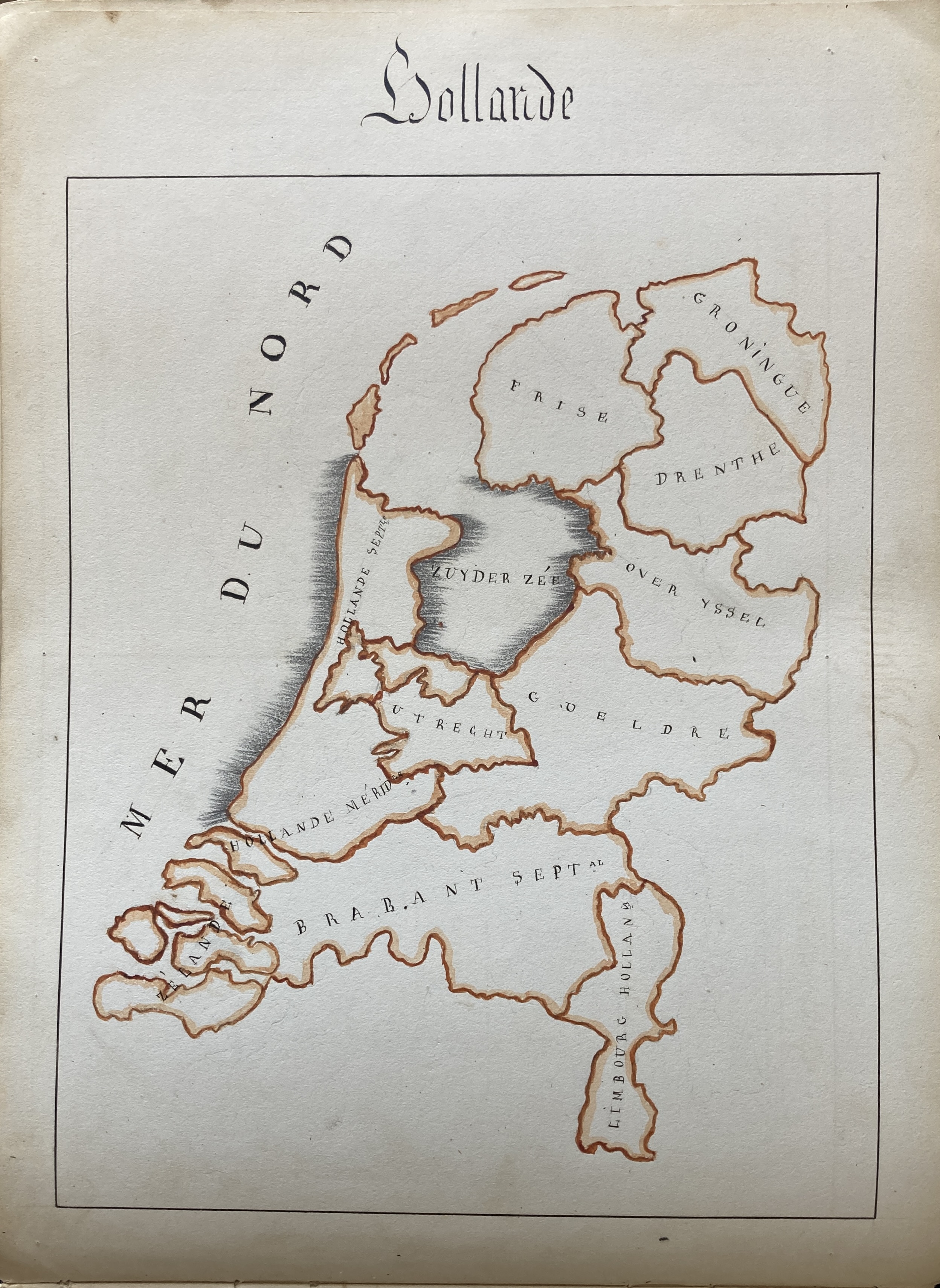
The volume is typical of French pedagogical practices in which students create formally designed book objects on the topic being studied, in this case with carefully hand-colored maps. The present volume offers a detailed account of 37 different regions of France, (Flanders, Alsace, Lorraine, Ile de France, Brittany, Normandy, Burgundy, etc.), each with a colored map, and 5 hand-colored maps for Belgium, the British Iles, Holland, Denmark, and Russia, with blanks leaves no doubt intended for maps of Switzerland and Sweden.
Uniformly presented, just as one would find in a published atlas, each entry is graphically laid-out with a central map, flanked on the right by a note for when the region became part of France (“Réunion de la Couronne”), and on the left the products and industries of the region. Below are the departments, principal cities, sub-prefectures, and remarkable sites (including cities, historic sites, architecture, etc.). Shown below, the Ile de France, including Paris, Versailles, Saint Denis, Vincennes, Fontainebleau, etc.